A 1972 series of Hornsey Journal articles by Ian Murray, first Chairman of Hornsey Historical Society and Haringey Council Archivist. The HHS gratefully acknowledges the kind permission of Archant/Ham and High for this reproduction.

From 1603 the court rolls of the Manor of Hornsey have fortunately been preserved. They tell us a great deal about the topography of the area – roads, fields, bridges, woods and so on – as well as about owners of property. As far as the population of the district is concerned, there is no really trustworthy source until the first census of 1801.
Population
The most useful source prior to this date is the Hearth Tax returns of 1674, a tax levied on the number of hearths in each house. From this it is possible to establish the number of houses in the parish and hence an approximation of the total population towards the end of the century. Earlier tax assessments which might yield figures for preceding centuries are not very helpful.
The Poll Tax returns for the late 1300s do not survive and the Subsidy Rolls for 1524, which are often used for population figures, give a total list of only 32 names paying £5 4s. 2d. This was a tax on all goods and lands of £1 a year in value, so clearly the returns are falsified or incomplete. The 1674 returns give a total of 156 inhabited houses which, if each held an average of six persons, gives a total population of under 1,000. It is generally thought that the population of the country increased substantially during the 16th and early 17th centuries due to better food and housing. So a population rise from 104 villein families at the time of Domesday would appear to be in accordance with national trends, bearing in mind the effects of the Black Death.
These figures also give the impression of the distribution of population. The largest number of houses lay in Highgate, 71 in all, which excludes those in the St Pancras part of the village. This is hardly surprising when one considers that Highgate had by this time attracted a large number of well-to-do Londoners because of its healthy elevation and was also important for its position on the main road out of London to the North. Highgate was followed by Hornsey village in size, the ancient centre of the parish. The remaining houses were spread out about the district with no more than 30 in Muswell Hill and Fortis Green.

Commons
The physical appearance of Hornsey can be ascertained both from the court rolls and from a survey of the manor compiled in 1647 when the manor was sold to Sir John Wollaston. He was a City alderman and a staunch supporter of the Parliamentarians in the Civil War. From this survey it is clear that out of a total of 3,034 acres for the whole parish, woods accounted for 650 acres and commons, land on which the tenants of the manor had the right to graze their beasts, for another 600.
Freeze Lane
On the commons also stood large numbers of trees, chiefly oak, elm and hornbeam worth £250. Wollaston paid £4,391 5. 4½d. for the manors of Finchley and Hornsey, though they were restored to the Church in 1660. Sufficient information can thus be gleaned for a conjectural map of Hornsey in the mid-17th century and this has already been done by previous historians. It shows that the main road structure has remained basically the same to this day with the exception of Southwood Lane which carried on straight through to Muswell Hill along what is now Muswell Hill Road and the Archway Road which was not built until later.

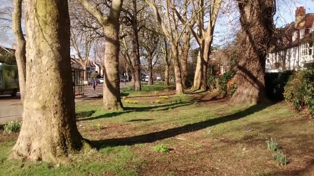
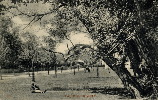
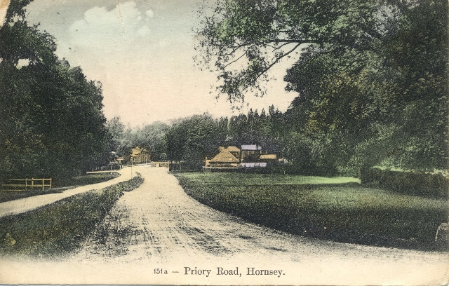
Middle Lane was then known as Freeze Lane. Hornsey Common stretched from the Finchley border to Fortis Green, skirting Coldfall Wood, while Muswell Hill Common took in a large part of the south side of Muswell Hill, the St James’s Lane area, and extended right down the hill as far as Hornsey High Street, along what is now Priory Road. The existence of common land along its side accounts for the present wide borders of Priory Road.
The sub-manors of Farnefields and Topsfield came within the jurisdiction of the Bishop’s Manor, but not Brownswood which at this date., although part of the parish, was a separate manor. Rowledge Farm, the large tract of land to the west of Crouch End was anciently the lord’s demesne but was by this time leased out. This is the general picture of Hornsey.
Image credits
HHS